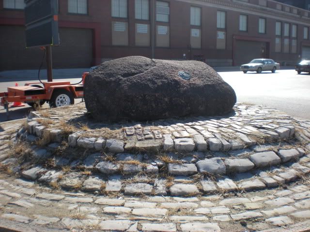
Fast forward to yesterday when Keith, Courtney, Robbie, and I were heading to St Charles for the Moolah Shrine Circus Parade. A section of highway 70 is closed for repairs, and we had to detour. As we are driving down North Broadway, I am telling them the story about how I tried to find this big rock on Produce Row, and Keith says, "You mean that big rock?"

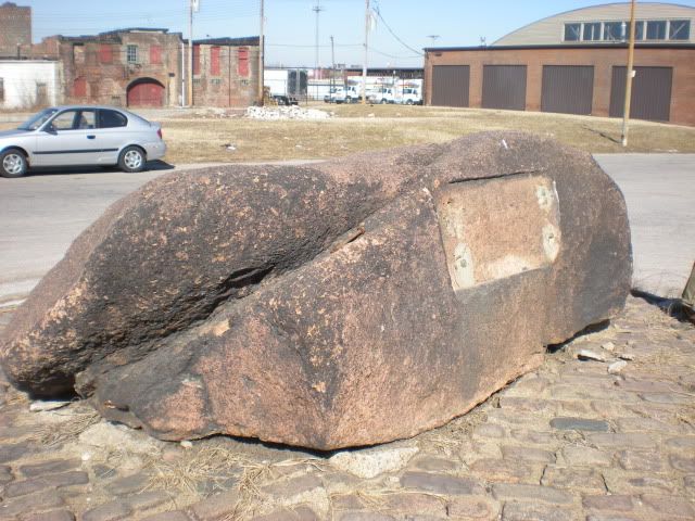
Holy cow, it was THAT big rock! So we flipped a u-ey and took some pictures. As it turns out, Sara found out more about it and I've done a little "digging" myself this afternoon. The big rock marks the site of the Big Mound, which was the largest Native American mound in the St Louis area. As the city spread north, the mounds were leveled. Big Mound was carted off by the wagonload, to be used as fill dirt in other areas, or to make bricks from the clay.

CC&G mobile in the background. Can you believe most weekends we cram 4 adults in that car?
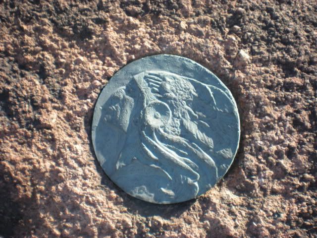
The sad thing is, there was once a plaque on this big rock, letting people know, well, why it is there. I'm sure it was made of a valuable metal and pried off - you can see evidence that similar attempt was made on the medallion on the other side. I'm sure very few people stop to see what that big rock is, but still, the missing plaque is shameful. This was all the more apparent to us yesterday since we were surrounded by cars with out of state plates who were forced to detour through a neighborhood that looks like a bombed out wasteland. I hope the Missouri History Museum can find a way to restore this monument in some way. If there is some kind of fund, or a problem that needs solving, let me know and I will post about it here.

Here is the satellite view if you want to check it out for yourself, maybe do some weeding while you are down there.
Further reading: An interesting article from the St Louis Post-Dispatch from a couple weeks ago about many of the things that have been found in the archeological dig going on at the sites to be used for the new Mississippi River bridge.

Great job on researching this Beth! So according to my boss, he believes the plaque was actually removed to ensure that it wasn't stolen. However a new one was never made to replace it. Not sure where to start on this, but it would be great to get a new plaque up especially since it is so near the Riverfront bike trail and could make for a nice historic detour.
ReplyDeleteI found out from <a href="http://ecoabsence.blogspot.com/2008/07/mound-marker.html" target="_blank>Ecology of Absence</a> that there is a Mound Heritage Trail Route being planned that will link the Cahokia site to the Big Mound marker, so I hope a new plaque is part of that plan!
ReplyDeleteDo you know what happened to the plaque, if it was purposely removed? I would love to know what it says.
I'm a student at MIT, and I'm working with my professor, Mark Jarzombek (web.mit.edu/mmj4/www/) on a book on global architecture. I'm interested in this photograph of yours to use in our book: http://smg.photobucket.com/albums/v199/nastyboots/obscure%20memorials/?action=view¤t=DSCN2961.jpg. The photo will be used in a survey history of art and architecture, and you would receive full attribution. I'm not sure yet how many copies will be printed, maybe a run of 8,000 or something like that - global distribution. If you are interested, please email me at ahw@mit.edu.
ReplyDeleteBest,
Alexander